History of the Eastern Churchyard, St. Peter’s Church (formerly the site of 20 Clarence St.):
BAH: STG, 8: “Naval vessels and mail steamers returning from the West Indies brought the dreaded yellow fever which swept through the town on no fewer than eight occasions between 1796 and 1864, with fatal consequences for townspeople and garrison troops alike.”
The graves in Area G of the churchyard (the Eastern section) range from 1819 to 1853 (Elmhurst, BDA PA 26; notes in Jarvis, St. Peter’s Churchyard Research File).
BAH: STG, 31–32: “In the churchyard extension, abutting Church Lane, is the Hearse House, built in the late 1850s. This building held the parish hearse when it was not in use. After St. Peter’s graveyard was closed following a deadly yellow fever epidemic in 1853, [Page break] the government built a new cemetery on the North Shore, about a mile from the church, necessitating the use of the hearse. The Hearse House matches the early Victorian Gothic style of St. Peter’s and the Sunday School. A small extension to the west was added in the 20th century.”
Burials were discontinued sometime after the yellow fever epidemic of 1853, except in special cases.
Walter B. Hayward, “The Churchyard,” in St. Peter’s Church, St. George’s, Bermuda [Green] (reprinted from Bermuda Historical Quarterly, 1954), 43, Jarvis, St. Peter’s Church Research File: “The yellow fever epidemic of 1853 led to the passage of an act forbidding any more burials in the old churchyard, and the Crown vested two acres of the western extremity of the Government park in the rector of St. George’s, subject to the same conditions as if the ground were a part of the yard of St. Peter’s.”
Based on the Hayward essay in St. Peter’s Church [Green], the cemetery did not reopen during the severe yellow fever epidemic of June 1864 (which is described in BAH: STG, 9).
W.F.S. Zuill, Bermuda Journey, 193: “The churchyard is also unusually interesting because of the sailors, soldiers, and seamen from many lands who have found there a last resting place. Burial in the graveyard was discontinued in 1853, when, probably as a result of recurring fever epidemics, it was decided to remove the cemetery to the north side of St. George’s Island. The western enclosure was the burial place of slaves, many of whose names are still to be seen engraved upon thin slabs of blue slate. So far as is known this is the only graveyard in the colony that had a special area for the purpose.”
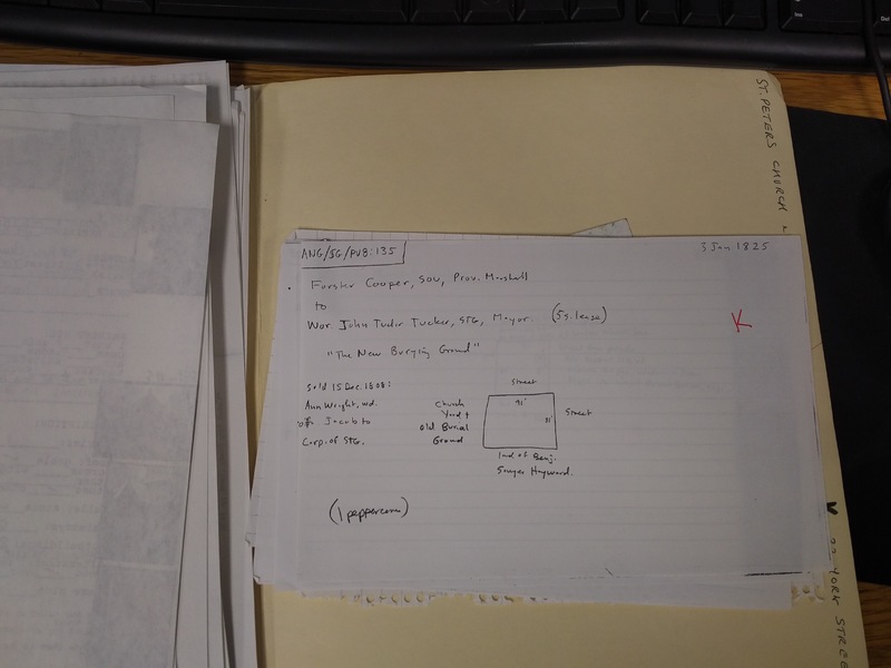
Forster Cooper, Provost Marshal, transferred to Wor. John Tudor Tucker, Mayor of St. George's, "the new burying ground," for 1 peppercorn rent [N:91', E:81']. The lot was still 91 feet along the north boundary and 81 feet along the east boundary. The church and old burial yard were to the west, while the property of Benjamin Sawyer Hayward was to the south. If the town already owned the cemetery by 1808, it is unclear why these individuals needed to perform this transaction. Note: BAH: STG, 178: Michael Jarvis lists Augustus J. Musson, not John Tudor Tucker, as the mayor of STG at this time. How to explain this discrepancy?
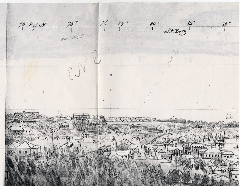
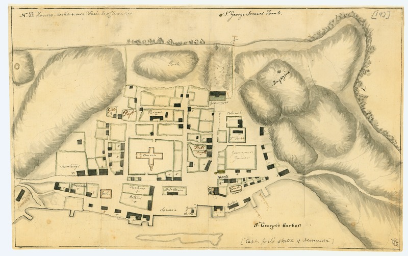
Thomas Driver’s black-and-white sketch looking to the northeast of St. George’s shows a building to the northeast just beyond St. Peter’s Church, but it is impossible to tell if this structure is Widow Wright’s former house or a building across the street. A building is visible to the church’s southeast; presumably this home is 37 York Street.
Driver’s painting of King Square correctly depicts 37 York Street as set back from the street, with 39 York Street to its southwest, abutting the street.
Driver’s version 3 of his Barracks Hill panorama, as well as his alternate version, reveals that, yes, Widow Wright’s house has been torn down. The panoramas do not shed much light on the York Street houses. The town hall building is visible, not 37 or 39 York Street. — Dan Gorman.
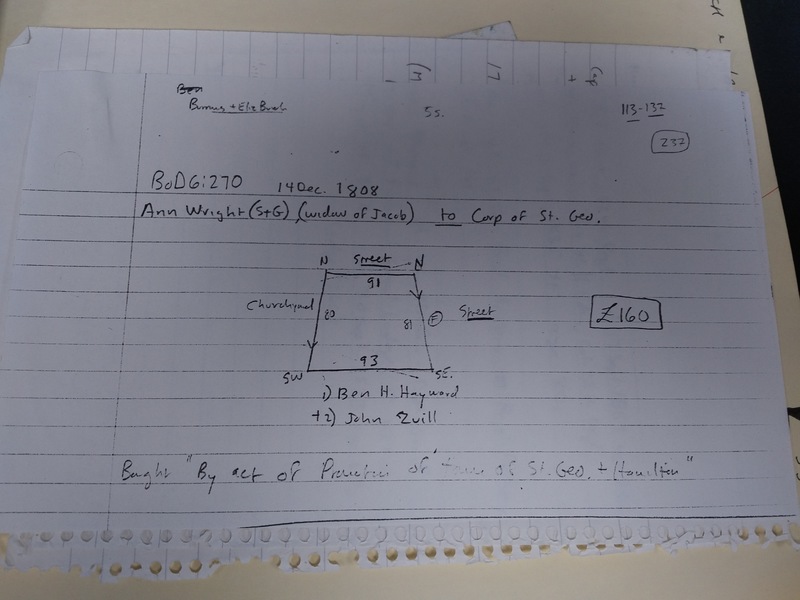
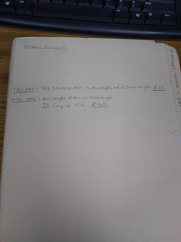
Ann Wright to Corporation of STG, for £160, commandeered by the Act for the Promotion of the Towns of St. George's and Hamilton. The lot’s dimensions were still N:91’, E:81’ (front), S: 93’, W: 80. The west side bordered the existing churchyard. The lots to the south now belonged to Ben H. Hayword [likely a misprint, referring to Ben Sawyer Hayword] and John Zuill. According to BoD6: 270, Wright’s lot was purchased “By act of Promotion [best guess] of town of St. Geo. + Hamilton.” Only £160 in remuneration may not seem much compared to the fancier houses sold in St. George’s, but Widow Wright actually got the best deal possible. See below.
BAH: STG, 29: “The eastern portion of [St. Peter’s] churchyard [replacing the house at 20 Clarence] was added in 1808 when the burial ground for whites became too crowded. It was not acquired without a fight. A house on the land was occupied by widow Ann Wright. When the church vestry tried to buy the lot from Wright in 1803, she refused to sell it because she had promised the property to her grandchildren. The Mayor, intent on getting the land, made her an offer: she would accept double the assessed value of the lot or he would get the government to commandeer the land by act of the House of Assembly. Widow Wright accepted the offer.”
Based on Michael Jarvis’s notes, the lot’s assessed value was therefore £80 in 1808.
Elizabeth Stowe (PEM, sp.), the sister of Jonathan Burchall, sold 20 Clarence St. to Ann Wright, STG, widow of Jacob Wright, for £12. In 1763, the lot to the south still belonged to John Briggs. The street to the lot’s north still was known as “the way to Walter Mitchell” and the future Clarence Street was still known as a path between the Miriam & John Briggs lots to Robert Burton’s lot.
Jonathan Burchall’s will (drawn up on 19 Oct. 1744) was proven. His address was listed as Pembroke, not St. George's. He named a sister, Elizabeth Stowe, and an aunt, Rebecca Cornuck, (widowed). Elizabeth executed the will. Witnesses: Edward Jones, Rebecca Cornuck. It would appear that Jonathan was estranged from his wife and children, who were still in St. George's.
Reference to “sweetheart” Miss Ruth Tynes (daughter of Benjamin the shipwright).
Note: Research Mix-up: In my research, I saw a reference to a “sweetheart,” Miss Ruth Tynes, daughter of Benjamin the shipwright, and that she was cited in Jonathan’s will. However, when I looked at the microfilm of the will, I could not find her name. Furthermore, when I reviewed my notes, I realized I had not recorded the source mentioning Ruth. Due to this mistake, I did not put Ruth in my essay on the history of 20 Clarence St. I welcome Prof. Jarvis’s assistance in tracking down this information, as a Ruth Tynes is mentioned in the STG Tax List Compilation.
Jonathan Burchall married Mary Brooke, the widow of the recently deceased Thomas Brooke, Collector of Customs. The new Mrs. Burchall sold off her husband’s old land to one Samuel Mills, who built the Buckingham house on the site. Mary Burchall moved with Jonathan to 20 Clarence St.
Humphrey Burchall’s will is proven. The document had been drafted on 16 April 1702:
"“Birchall, Humphrey TSTG. w. 16th April 1712
ref.: W4: 159. pr. 20th June 1713
To loving wife Mary Birchall – my whole estate for her life.
To Son Jonathan – [my?] new [dwelling?] house in St Georges & his heirs forever. + one negro boy ‘George’?
To daughter Mary – one negro girl called Nancy
To daughter Abigail one negro girl Jeaney?
To daughter Rebecca – one negro girl Idry?
Rest of estate to be equally divided between 4 children after his wifes death.” His brother was Robert Burchall, who executed the will along with Jonathan the son. Witnesses: Henry Smith, James Burchall.”
These highlights from the will, copied in Michael Jarvis’s "Cigar Box" collection of Will records, captures the highlights well from Burchall’s will — good enough for government work, as they say.
20 Clarence St. was granted [N:91',S:93',E:81' front, W: 80'] to Jonathan Burchall, mariner, son of Humphrey Burchall, presumably upon the death of the father. The street to the property's north was called the “way leading from town well by the Church yard to house in occ. of Walter Mitchell, gent.”
The east street (Prince/the future Clarence Street) was labeled “Street from parade between several lots of Miriam Briggs, widow, + John Briggs to Lot of Robert Burton, esq.” The lot to the immediate south of the 20 Clarence lot (22 Clarence/39 York) belonged to one John Briggs.
Miriam Briggs owned several lots along Clarence Street, one of which became the site of the YMCA (corner of York and Clarence) in 1862.
20 Clarence Street was apparently the house of Henry Burchall at this time. It is unclear why Humphrey Burchall was temporarily not in control of the property. When Humphrey drew up his will on 16 April 1702, he owned the house again.
The construction of the wooden St. Peter’s Church, which several houses and the church graveyard eventually abutted. Governors Miles Kendall and Nathaniel Butler oversaw the construction.
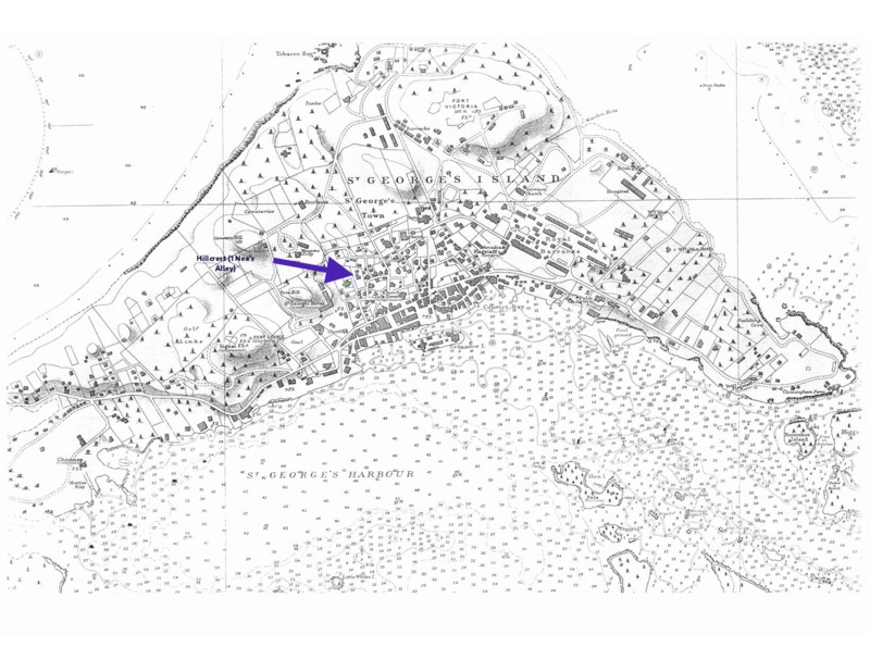
Opened as Hillcrest Guest House. SUMMARY: symmetrical U-shaped two-storey, hip roof core with two large internal chimneys at the east and west ends; quoins, triple keystones and St. George’s eaves [probably added later]; northern hip roof addition to west wing by 1854 with internal chimney (kitchen); wooden verandah added 1854-76, replaced with a concrete one in the early 20th century; parapet extension in back added after 1898.
Space in U filled, addition to north wing still there, long rectangular detached building close to house to north, running east-west; verandah in front, walled garden to east of house, two small privies/outbuildings to SW and NW (4-seater privy) of house
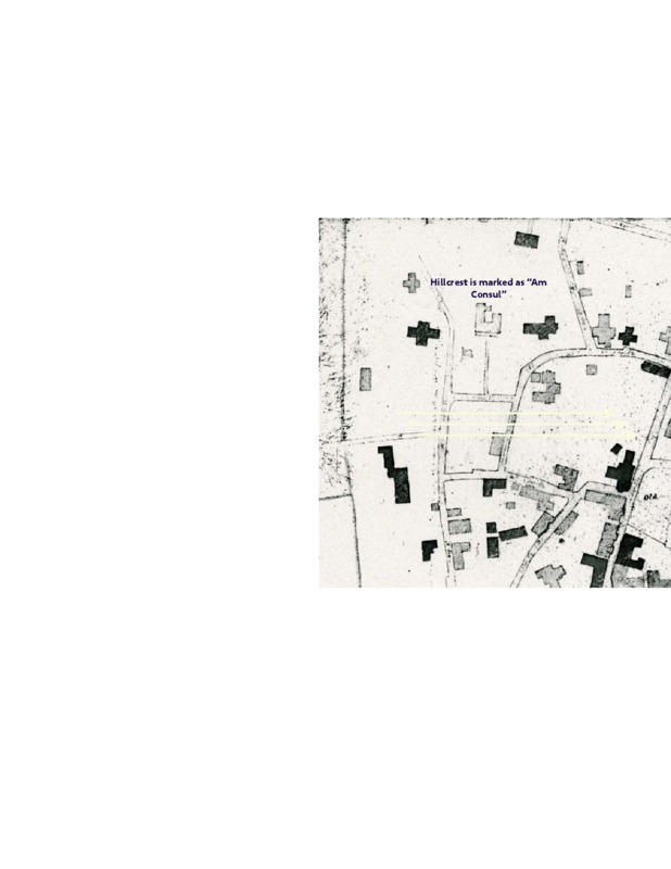
U-shaped building facing south with addition to north side of west wing, flagstaff to SE of house, long path from house to Nea’s Alley in front, labelled “American Consul”
David Ross Lee, Deputy Asst. Commissary General at Belize, Honduras and wife Henrietta [nee Higinbothom, daughter of Eliza & W.R. Higinbothom and great granddaughter of Richard Prudden] sells 4/5 share of house and 1/6 lot to William Tudor Tucker for £70